Faroe Islands: Cliffs, Culture & Island Life
Island Ecology, Seabirds & North Atlantic Culture · International · 8 Days

Faroe Islands: Cliffs, Culture & Island Life

See how the North Atlantic shapes island life

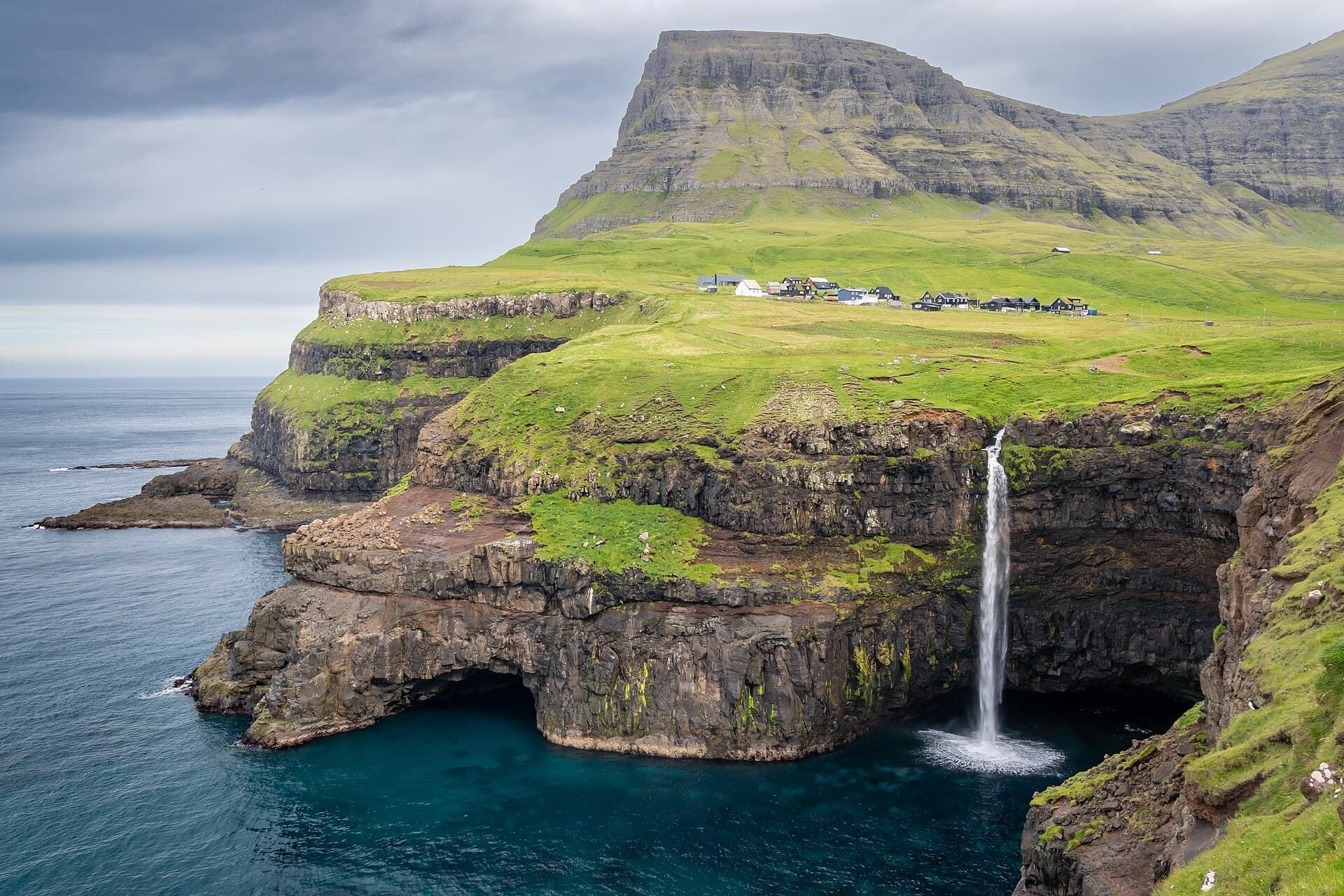
The Faroe Islands show students what happens when people build lives on steep rock in the middle of the North Atlantic. Villages like Gásadalur sit between sea cliffs and waterfalls, and students trace how wind, tides, and limited land decide where people can live. In Tórshavn, one of the world's smallest capitals, the National Museum and the old town carry the story from Viking settlement to today's self-governing islands. A boat journey under the Vestmanna bird cliffs puts seabird ecology directly in front of students, and the islands' tunnels and working harbors reveal the engineering that keeps far-flung villages connected.

Curriculum Connection

Four objectives, one living classroom

Island Geography & Field Observation

Use Múlafossur, Saksun, and Gjógv to identify how volcanic rock, ocean erosion, and limited buildable land shape Faroese landscapes and settlement patterns.

Explore this objective

At Múlafossur and Gjógv, students can read the cliffs as stacked basalt lava flows later carved by ice, rain, rivers, and the North Atlantic. Comparing Gásadalur’s former isolation with modern tunnel access turns physical geography into a practical question about where communities can build, travel, and remain connected.

Close objective

Seabird Ecology

From the Vestmanna boat and shoreline viewpoints, students observe seabirds at a respectful distance and see how nesting cliffs, seasonal migration, and marine food webs fit together in the North Atlantic.

Explore this objective

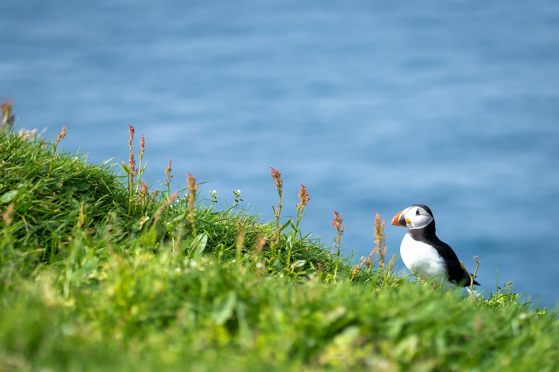
From the boat, students record which birds use exposed ledges, crevices, and open water, asking why breeding colonies concentrate in particular parts of the cliff. Faroese puffin research connects breeding success with forage fish such as sandeels, allowing observations at Vestmanna’s nesting cliffs to open a discussion of how changes below the water affect birds above it.

Close objective

Viking Heritage & Living Culture

Compare Viking-era evidence, medieval church power, and parliamentary traditions at the National Museum, Kirkjubøur, and Tinganes.

Explore this objective

At the National Museum, students place the Faroese boat and Viking finds beside later Kirkjubøur bench ends to see how objects preserve different periods of island history. Roykstovan, Ólavskirkja, and Magnus Cathedral then help them trace the movement from early settlement toward medieval church and political power, while Tinganes shows that governance remains part of the living landscape.

Close objective

Sustainable Island Living

Examine how working harbors, subsea tunnels, and village design connect and support small communities spread across steep islands.

Explore this objective

The Eysturoy subsea tunnel gives students a measurable example of infrastructure changing island life: the government estimated that it would reduce the Tórshavn–Klaksvík drive from 68 to 36 minutes. At Klaksvík’s working harbor, they can connect local boats and processing activity to an economy where seafood represents about 95 percent of Faroese goods exports, then weigh the benefits and dependencies created by that specialization.

Close objective

The Learning Arc

Intentional learning design

We design each tour with a scaffolded thematic progression wherever the destination and itinerary allow: each day establishes context, gives students evidence to work with, and prepares them for the next idea.

Theme the day. Encounter the evidence. Reflect and connect.

Each day begins with a clear theme and the context students need. At each site, our Storyteller Guides direct attention to the objects, documents, spaces, and stories that make the theme concrete. Short discussions and reflection prompts help students connect the experience to prior learning and carry an idea forward to the next day.

Tour Highlights

What your group will see

Vágar, Streymoy & Living History

  • Bøur, Gásadalur, and Múlafossur for waterfall processes, mountain barriers, and tunnel access
  • Tinganes, Reyn, and the Faroe Islands National Museum for parliament, artifacts, natural history, Viking evidence, language, and national identity
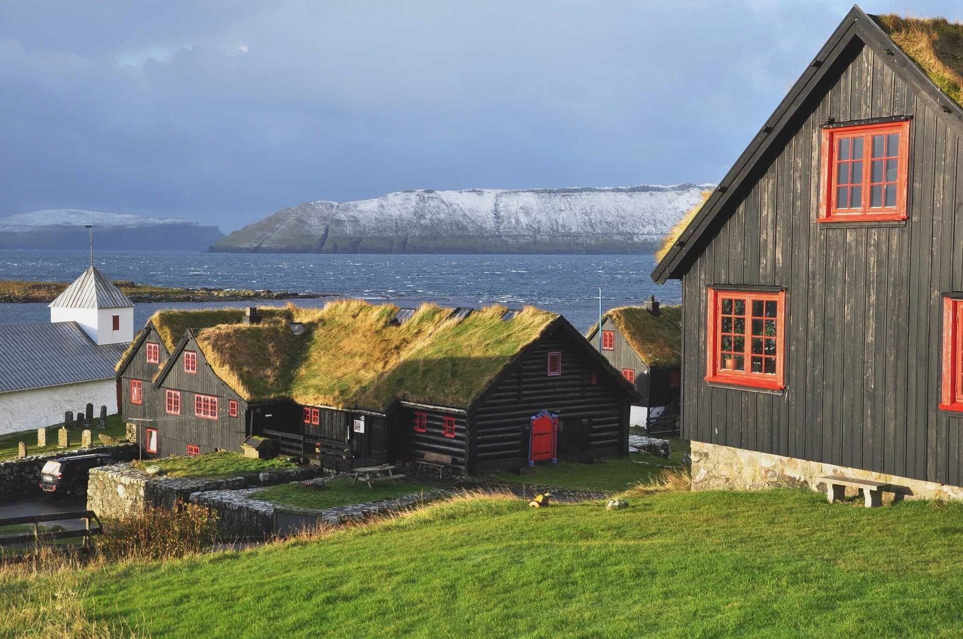
  • Kirkjubøur and Saksun for medieval church history, traditional farm life, turf-roofed buildings, a tidal lagoon, and changing relationships between land and water

Sea Cliffs, Working Harbors & Island Connections

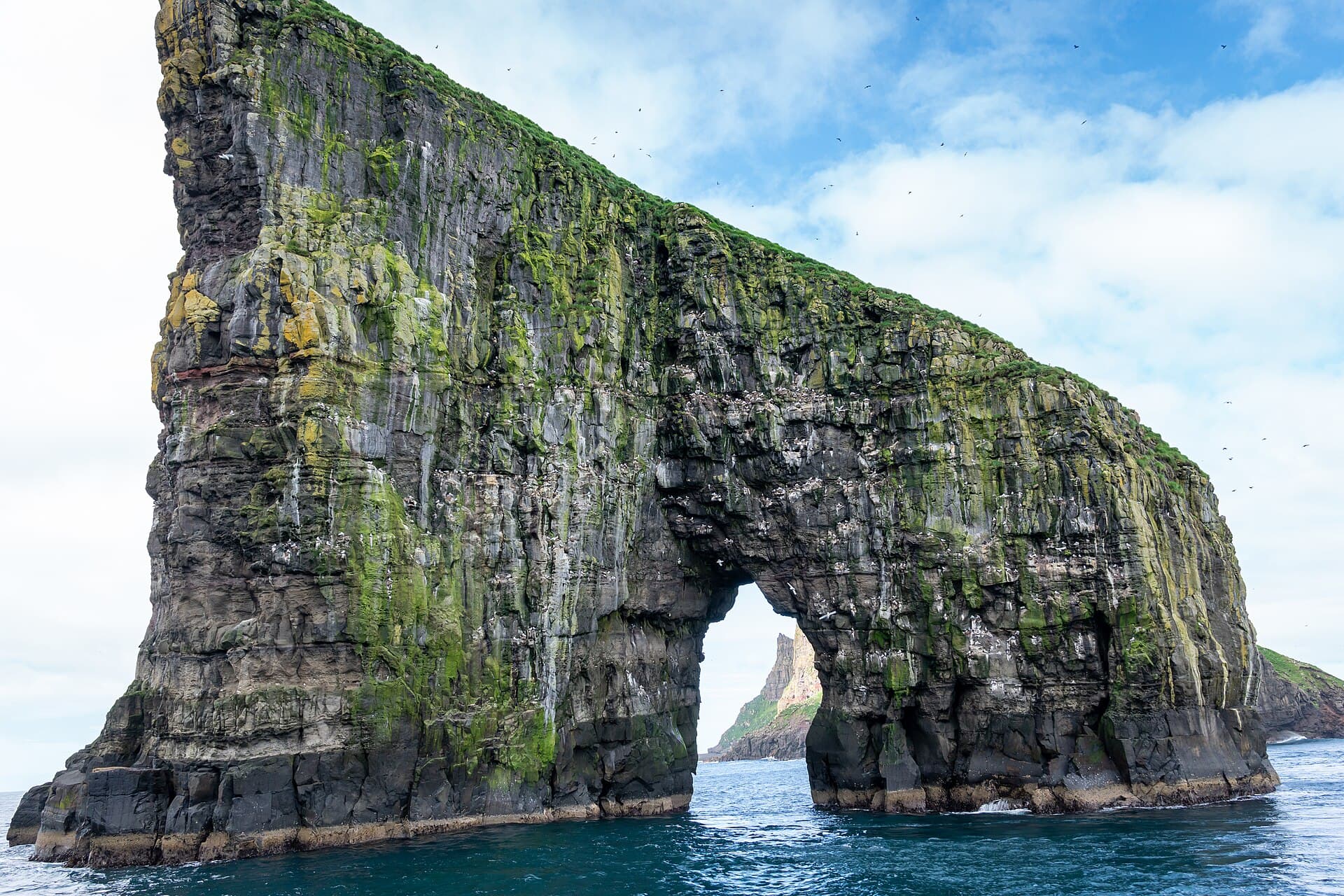
  • A reserved Vestmanna Bird Cliffs boat journey for basalt walls, sea caves, nesting habitat, seabirds, and North Atlantic conditions
  • Eiði and Gjógv for mountain roads, a sea-filled gorge, compact settlement, and the visible effects of terrain on village life
  • Klaksvík, Viðareiði, and the subsea tunnels that keep the Northern Islands' fishing communities working and connected
Day by Day

The route your group travels

1
Overnight Flight to the Faroe Islands

Learning theme/Questions, Geography & Journey Framing

Begin the North Atlantic Field Study

Depart together on an overnight group flight toward the Faroe Islands. Before arrival, students locate the 18-island archipelago, Vágar, Streymoy, Eysturoy, and the Northern Islands on a shared map and begin route questions about geology, weather, seabirds, settlement, transport, and the choices required by limited land.
2
Vágar Airport → Tórshavn

Learning theme/Island Geography, Culture & Adaptation

Enter the Islands through Tórshavn

Arrive on Vágar and cross the subsea tunnel to Streymoy. After a meal break, follow a local guide through Tinganes, Reyn, and the harbor. Students read turf roofs, narrow lanes, government buildings, boats, and waterfront geography, a first look at a capital where old traditions and modern island life share the same streets.

3
Tórshavn & Kirkjubøur

Learning theme/Evidence, Institutions & Cultural Continuity

Trace Faroese History through Objects and Place

Begin at the Faroe Islands National Museum, comparing geology and marine zoology with Viking finds, traditional clothing, the Faroese boat, and the Kirkjubøur bench ends. Continue south to Kirkjubøur for Roykstovan, Ólavskirkja, and the ruins of Magnus Cathedral, connecting artifacts to medieval religious and political power in the landscape where that history unfolded.

4
Vágar: Bøur & Gásadalur

Learning theme/Water, Relief & Village Access

Explore the Western Islands from Road to Waterfall

Return through the Vágar tunnel for a field day in Bøur and Gásadalur. At the marked Múlafossur viewpoint, students observe the complete waterfall, cliffs, village, and view toward Mykines while examining how steep terrain once isolated communities and how tunnels changed access.

5
Vestmanna & Saksun

Learning theme/Seabird Habitat, Sea Cliffs & Tidal Landscapes

Observe North Streymoy from Sea and Shore

Take the reserved approximately 90-minute Vestmanna Bird Cliffs boat journey beneath basalt walls, sea caves, and seasonal nesting habitat. After lunch, continue by road to Saksun to compare the enclosed tidal lagoon, church, and active farm landscape.

6
Eysturoy: Eiði & Gjógv

Learning theme/Terrain, Engineering & Settlement

Connect Mountain Villages across Eysturoy

Use the Eysturoy subsea tunnel to reach a full-day route through Eiði and Gjógv. From village paths and viewpoints, students compare mountain roads, limited flat land, turf-roofed homes, the sea-filled gorge, harbor access, and seasonal visitor pressure.

7
Northern Islands: Klaksvík & Viðareiði

Learning theme/Working Harbors & Sustainable Island Living

Study How the Northern Islands Stay Connected

Travel through the subsea tunnels to Klaksvík, where a guided harbor study examines fishing, working vessels, trade, and the town’s role as the Northern Islands’ transport hub. Continue by road to Viðareiði for a village-based observation of stone walls, steep mountains, coastal resources, memorial traditions, and the realities of community life in an exposed landscape.

8
Tórshavn → Vágar Airport

Learning theme/Synthesis & Global Connections

Bring the Island Systems Together

Before the return flight, students pull the week's evidence together. Each student identifies one way physical geography shapes Faroese life and one way people have adapted to the islands’ natural limits, then the group transfers through the Vágar tunnel to the airport.

Homeward
Gallery

Faroe Islands: Cliffs, Culture & Island Life in pictures

Image credits

Múlafossur Waterfall: Ekrem Canli (CC BY-SA 4.0); Atlantic Puffins: Ekrem Canli (CC BY-SA 4.0); Kirkjubøur Turf-Roofed Farmhouse: Vincent van Zeijst (CC BY-SA 3.0); Drangarnir Sea Arch: Ekrem Canli (CC BY-SA 4.0); Tinganes and Tórshavn Harbour: Stig Nygaard (CC BY 2.0); Mykines Island: DavideGorla (CC BY 2.0); Vestmanna Bird Cliffs: Erik Christensen (CC BY-SA 3.0); Saksun Valley: kallerna (CC BY-SA 4.0); Gjógv Village and Sea Gorge: Ekrem Canli (CC BY-SA 4.0); Sørvágsvatn from Trælanípa: Ekrem Canli (CC BY-SA 4.0)

The Details

What's included

  • International airfare to and from the Faroe Islands
  • Private motorcoach, the Vestmanna boat excursion, and local transportation throughout the tour
  • Hotel accommodations
  • All meals; no meal money or dining extras required
  • All scheduled admissions, activities, and guided excursions
  • Experienced educational guide and curriculum-connected trip planning
  • Curriculum-connected activities and learning materials
  • Group enrollment and payment-plan support

Not included

  • Travel and trip cancellation insurance
How Planning Works

Three steps to a trip that fits your group

1

Tell us about your group

Who's traveling, when, and where you're coming from. That's all we need to start.

2

We build your quote

Itinerary, hotels, and motorcoach, priced for your group size and your dates.

3

Refine it with your advisor

Adjust the days, the stops, and the pace until it fits. We handle the rest.

Ready to plan your Faroe Islands: Cliffs, Culture & Island Life trip?

Tell us your group and your dates. We’ll take it from there.

Request a Quote